Green vegetation biomass estimation in Mongolia using RS data and machine-learning methodsing methods
Keywords:
AGB, RF, ANN, XGB, pastureland ecosystemsAbstract
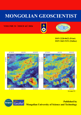
Green vegetation biomass is a key ecological indicator reflecting ecosystem productivity, rangeland condition, and responses to climate variability, particularly in arid and semi-arid environments. In Mongolia, where vast grassland and desert-steppe ecosystems support both biodiversity and pastoral livelihoods, spatially explicit biomass information is essential for ecological monitoring and conservation-oriented land management. Traditional field-based biomass measurements, however, are labor-intensive and limited in spatial coverage. In this study, we estimated aboveground biomass of green vegetation across Mongolia using moderate-resolution remote sensing data and machine learning methods to support large-scale ecological assessment. Three spectral bands and nine vegetation indices derived from Moderate Resolution Imaging Spectroradiometer MOD13A1 data from August 2021 were combined with field measurements from 275 monitoring sites. Random forest, artificial neural network, and extreme gradient boosting \ models were trained and optimized using grid-search hyperparameter tuning and evaluated through cross-validation. Among the tested models, Random forest achieved the highest predictive accuracy (R² = 0.88, MAE = 68.45 kg ha⁻¹, RMSE = 109.93 kg ha⁻¹), followed by extreme gradient boosting (R² = 0.80, MAE = 87.47 kg ha⁻¹, RMSE = 143.09 kg ha⁻¹), while artificial neural network showed comparatively lower performance. The resulting biomass maps reveal pronounced spatial variability linked to Mongolia’s climatic and ecological gradients. Our findings demonstrate that machine learning methods combined with remote sensing provide an efficient framework for estimating vegetation biomass across Mongolia under the environmental conditions represented by the August 2021 dataset. The generated biomass products offer valuable ecological insights and can support rangeland monitoring, conservation planning, and assessments of ecosystem vulnerability under ongoing climate change.
70
References
Adyasuren, Ts. 1989. Remote sensing technology for evaluation of biomass in Mongolia. Doctoral thesis, Ulaanbaatar, Mongolia.
Ahmetoglu, H., Das, R. 2022. A comprehensive review on detection of cyber-attacks: Data sets, methods, challenges, and future research directions. Internet of Things, vol. 20, 100615. https://doi.org/10.1016/j.iot.2022.100615
Altanchimeg, T., Damdinsuren, A., Tseveen, B., Batdorj, B. 2022. Analysis of Relations Between Aboveground Biomass and Vegetation Indices Derived from Sentinel-2 Satellite Data. Journal of Institute of Mathematics and Digital Technology, vol. 4(1), p. 94–100 (in Mongolian with English abstract) https://doi.org/10.5564/jimdt.v4i1.2666
Amarsaikhan, E., Enkhjargal, D., Jargaldalai, E., Amarsaikhan, D. 2024. Comparison of machine learning and parametric methods for the discrimination of urban land cover types. Geocarto International, vol. 39(1), 2380372. https://doi.org/10.1080/10106049.2024.2380372
Amarsaikhan, E., Erdenebaatar, N., Amarsaikhan, D., Otgonbayar, M., Bayaraa, B. 2023. Estimation and mapping of pasture biomass in Mongolia using machine learning methods. Geocarto International, vol. 38(1), p. 1–17. https://doi.org/10.1080/10106049.2023.2195824
Benseghir, L., Bachari, N.E.I. 2021. Shortwave infrared vegetation index-based modelling for aboveground vegetation biomass assessment in the arid steppes of Algeria. African Journal of Range & Forage Science, vol. 38(4), p. 281–290. https://doi.org/10.2989/10220119.2021.1882575
Chan, K.Y., Salih, B.A., Qaddoura, R., Al-Zoubi, A.M., Palade, V., Pham, D-C., Ser, J.D., Muhammad, K. 2023. Deep neural networks in the cloud: Review, applications, challenges and research directions. Neurocomputing, vol. 545, 126327. https://doi.org/10.1016/j.neucom.2023.126327
Chen, Y., Guerschman, J., Shendryk, Y., Henry, D., Harrison, M.T. 2021. Estimating Pasture Biomass Using Sentinel-2 Imagery and Machine Learning. Remote Sensing, vol. 13(4), 603. https://doi.org/10.3390/rs13040603
Chiarito, E., Cigna, F., Cuozzo, G., Fontanelli, G., Aguilar, A.M., Paloscia, S., Rossi, M., Santi, E., Tapete, D., Notarnicola, G. 2021. Biomass retrieval based on genetic algorithm feature selection and support vector regression in Alpine grassland using ground-based hyperspectral and Sentinel-1 SAR data. European Journal of Remote Sensing, vol. 54(1), p. 209–225. https://doi.org/10.1080/22797254.2021.1901063
Dorigo, W.A., Zurita-Milla, R., de Wit, A.J.W., Brazile, J., Singh, R., Schaepman, M.E. 2007. A review on reflective remote sensing and data assimilation techniques for enhanced agroecosystem modeling. International Journal of Applied Earth Observation and Geoinformation, vol. 9(2), p. 165–193. https://doi.org/10.1016/j.jag.2006.05.003
Enkhtuya J., Altangerel, M., Damdinsuren, A., Oczipka, M., Gurdorj, A., Enkhbayar, B., Tovuusuren B. 2022. Analysis of vegetation indices for pasture biomass evaluation using multi-temporal satellite images and UAV data. 2022. Proceedings of the 43rd Asian Conference on Remote Sensing (ACRS 2022), Ulaanbaatar, Mongolia, ACRS22_38. https://acrs-aars.org/proceedings2022/
Harris, C.D., Lattimore, O., Sanders, A.J.K. 2023. Mongolia. In Encyclopedia Britannica. https://www.britannica.com/place/Mongolia
He, D., Huang, X., Tian, Q., Zhang, Z. 2020. Changes in vegetation growth dynamics and relations with climate in Inner Mongolia (2000–2018). Sustainability, vol. 12(6), 2534. https://doi.org/10.3390/su12062534
Hill, M.J., Zhou, Q., Sun, Q., Schaaf, C.B., Southworth, J., Mishra, N.B., Gibbes, C., Bunting, E., Christiansen, T.B., Crews, K.A. 2016. Dynamics of the relationship between NDVI and SWIR32 vegetation indices in southern Africa: implications for retrieval of fractional cover from MODIS data. International Journal of Remote Sensing, vol. 37(6), p. 1476–1503. https://doi.org/10.1080/01431161.2016.1154225
Huete, A., Didan, K., Miura, T., Rodriguez, E.P., Gao, X., Ferreira, L.G. 2002. Overview of the radiometric and biophysical performance of the MODIS vegetation indices. Remote Sensing of Environment, vol. 83(1–2), p. 195–213. https://doi.org/10.1016/S0034-4257(02)00096-2
Jamiyansharav, K., Fernández-Giménez, M.E., Angerer, J.P., Yadamsuren, B., Dash, Z. 2018. Plant community change in three Mongolian steppe ecosystems 1994–2013: applications to state-and-transition models. Ecosphere, vol. 9(3), e02145. https://doi.org/10.1002/ecs2.2145
Klinge, M., Dulamsuren, C., Erasmi, S., Karger, D.N., Hauck, M. 2018. Climate effects on vegetation vitality at the treeline of boreal forests of Mongolia. Biogeosciences, vol. 15(5), p. 1319–1333. https://doi.org/10.5194/bg-15-1319-2018
Klinge, M., Sauer, D. 2019. Spatial pattern of Late Glacial and Holocene climatic and environmental development in Western Mongolia - A critical review and synthesis. Quaternary Science Reviews, vol. 210, p. 26–50. https://doi.org/10.1016/j.quascirev.2019.02.020
Kogan, F., Stark, R., Gitelson, A., Jargalsaikhan, L., Dugrajav, C., Tsooj, S. 2004. Derivation of pasture biomass in Mongolia from AVHRR-based vegetation health indices. International Journal of Remote Sensing, vol. 25(14), p. 2889–2896. https://doi.org/10.1080/01431160410001697619
Kumar, L., Sinha, P., Taylor, S., Alqurashi, A.F. 2015. Review of the use of remote sensing for biomass estimation to support renewable energy generation. Journal of Applied Remote Sensing, vol. 9(1), 097696. https://doi.org/10.1117/1.JRS.9.097696
Lamchin, M., Lee, J-Y., Lee, W-K., Lee, E.J., Kim, M., Lim, C-H., Choi, H-A., Kim, S-R. 2016. Assessment of land cover change and desertification using remote sensing technology in a local region of Mongolia. Advances in Space Research, vol. 57(1), p. 64–77. https://doi.org/10.1016/j.asr.2015.10.006
Lin, S., Hu, Z., Wang, Y., Chen, Y., He, B., Song, Z., Sun, S., Wu, C., Zheng, Y., Xia, X., Liu, L., Tang, J., Sun, Q., Joos, F., Yuan, W. 2023. Underestimated Interannual Variability of Terrestrial Vegetation Production by Terrestrial Ecosystem Models. Global Biogeochemical Cycles, vol. 37(4), e2023GB007696. https://doi.org/10.1029/2023GB007696
Lourenco, P. 2021. Biomass Estimation Using Satellite-Based Data. In: Forest Biomass: From Trees to Energy. IntechOpen. https://doi.org/10.5772/intechopen.93603
Matiza, C., Mutanga, O., Peerbhay, K., Odindi, J., Lottering, R. 2024. Assessing above-ground biomass in reforested urban landscapes using machine learning and remotely sensed data. Journal of Spatial Science, vol. 69(3), p. 1047–1027. https://doi.org/10.1080/14498596.2024.2343764
Meng, X., Gao, X., Li, S., Lei, J. 2020. Spatial and Temporal Characteristics of Vegetation NDVI Changes and the Driving Forces in Mongolia during 1982–2015. Remote Sensing, vol. 12(4), 603. https://doi.org/10.3390/rs12040603
Mills, P. 2011. Efficient statistical classification of satellite measurements. International Journal of Remote Sensing, vol. 32(21), p. 6109–6132. https://doi.org/10.1080/01431161.2010.507795
Nyamjargal, E., Amarsaikhan, D., Munkh-Erdene. A., Battsengel, V., Bolorchuluun, Ch., 2019. Object-based classification of mixed forest types in Mongolia. Geocarto International, vol. 35(14), p. 1615-1626. https://doi.org/10.1080/10106049.2019.1583775
Nyamsuren, B., Nasahara, K.N., Kubota, T., Masaki, T. 2019. Vegetation mapping using GPM/DPR. Remote Sensing, vol. 11(20), 2386. https://doi.org/10.3390/rs11202386
Otgonbayar, M., Atzberger, C., Chambers, J., Damdinsuren, A. 2018. Mapping pasture biomass in Mongolia using Partial Least Squares, Random Forest regression and Landsat 8 imagery. International Journal of Remote Sensing, vol. 40(8), p. 1–23. https://doi.org/10.1080/01431161.2018.1541110
Portela, M.G.T., de Espíndola, G.M., Valladares, G.S., Amorim, J.V.A., Frota, J.C.O. 2020. Vegetation biomass and carbon stocks in the Parnaíba River Delta, NE Brazil. Wetlands Ecology and Management, vol. 28, p. 607–622. https://doi.org/10.1007/s11273-020-09735-y
SDC (Swiss Agency for Development and Cooperation), GGP (Green Gold Program). 2015. National Report on the Rangeland Health of Mongolia. Ulaanbaatar, Mongolia, 66 p.
Sternberg, T., Tsolmon, R., Middleton, N., Thomas, D. 2011. Tracking desertification on the Mongolian steppe through NDVI and field-survey data. International Journal of Digital Earth, vol. 4(1), p. 50–64. https://doi.org/10.1080/17538940903506006
Wesche, K., Ambarlı, D., Kamp, J., Torok, P., Treiber, J., Dengler, J. 2016. The Palaearctic steppe biome: a new synthesis. Biodiversity and Conservation, vol. 25(12), p. 2197–2231. https://doi.org/10.1007/s10531-016-1214-7
Zhang, W., Gu, X., Hong, L., Han, L., Wang, L. 2023. Comprehensive review of machine learning in geotechnical reliability analysis: Algorithms, applications and further challenges. Applied Soft Computing, vol. 136, 110066. https://doi.org/10.1016/j.asoc.2023.110066
Downloads
Published
Issue
Section
License
Copyright (c) 2026 Dandinsuren Amarsaikhan, Dalantai Sainbayar, Enkhtuya Jargaldalai, Enkhmanlai Amarsaikhan, Gendaram Odontuya, Enkhjargal Egshiglen, Damdin Enkhjargal, Tsedev Bat-Erdene

This work is licensed under a Creative Commons Attribution 4.0 International License.
Copyright on any research article in the Mongolian Geoscientist is retained by the author(s).
The authors grant the Mongolian Geoscientist a license to publish the article and identify itself as the original publisher.

Articles in the Mongolian Geoscientist are Open Access articles published under a Creative Commons Attribution 4.0 International License CC BY.
This license permits use, distribution and reproduction in any medium, provided the original work is properly cited.
How to Cite